How important is hiking safety?
Whether you are ascending or descending on steep hill and mountain sides danger is only one step away, particularly in descent.
The worst type of steep ground is loose scree and rocks, wet grass, mud and of course snow and ice.
Even a very steep path can be tricky and long descents make your legs tired and increase the possibility of an accident.
On a lot of hills and mountains you will not be able to avoid steep ground but if you can read the signs on your map you may be able to avoid the worst of it and increase your hiking safety.
What are the mapping signs that point to steep ground?
Hiking maps show variations in the height of land by the inclusion of contour lines that weave their way all over a map.
At first sight they can appear confusing and unreadable.
Contour lines require close scrutiny.
On 1:50,000 and 1:25,000 maps – the thin brown lines represent 10 meter changes in height and the thicker brown lines represent 50 meter changes.
When depicting very steep ground the contour lines are much closer together AND also because of a lack of space the lesser brown lines are sometimes omitted by the map maker.
Therefore you may only be looking on the map at the closeness of the thicker brown contour lines
It is only when you recognize this on your map that you can fully appreciate how steep that section of the hill or mountain really is. You can then compare that to the rest of the mountain side and select a less steep and therefore a usually safer route.
Generally if I see more than 3 or 4 thick contour lines in 1 cm on a 1:25,000 map I know that it is best avoided.
If I see more than say 6 or 7 thick contour lines in 1 cm on a 1:50,000 map I know that it is best avoided.
Route finding will be affected by the nature of the terrain and the weather as well as steepness, and your own ability and experience will also play a major part in your decision to ascend or descend a particular route.
If in doubt finder an easier route even if it is longer.
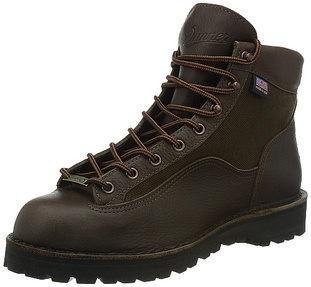
Safety Boot
A pair of good quality and lightweight hiking & work boots is important to ensure the safety when going to hike on steep terrain. Therefore, you need to choose a pair which are comfort to wear and also can provide good protection for your foot.
Hiking on Steep Ground
Making your way up to a summit will usually feel safer than descending the same steep ground (assuming you are not on a narrow and exposed ridge).
Whether you are ascending or descending using a pair of hiking poles can significantly help your hiking safety as will taking shorter steps.
Use short poles going up and extended poles going down. In descent you should find it easier if you keep your knees slightly bent and your body weight back so that you are in a partial sitting position. Your center of gravity will be lower and this will help you maintain good balance especially when combined with the use of long poles.
Keep the poles in front (and to each side) of you and make them absorb some of the downward motion. Your descent will then be easier on your knees and maintaining good balance will lessen the chance of a slip or a fall.
Another way of easing a descent is to zigzag down following the natural contours of the land. On very steep ground this might be the only safe method. The nature of the terrain and your own experience and ability will determine the rate and manner of your progress but always keep your speed and balance under strict control!
Whether you are ascending or descending on steep hill and mountain sides danger is only one step away, particularly in descent.
The worst type of steep ground is loose scree and rocks, wet grass, mud and of course snow and ice.
Even a very steep path can be tricky and long descents make your legs tired and increase the possibility of an accident.
On a lot of hills and mountains you will not be able to avoid steep ground but if you can read the signs on your map you may be able to avoid the worst of it and increase your hiking safety.
What are the mapping signs that point to steep ground?
Hiking maps show variations in the height of land by the inclusion of contour lines that weave their way all over a map.
At first sight they can appear confusing and unreadable.
Contour lines require close scrutiny.
On 1:50,000 and 1:25,000 maps – the thin brown lines represent 10 meter changes in height and the thicker brown lines represent 50 meter changes.
When depicting very steep ground the contour lines are much closer together AND also because of a lack of space the lesser brown lines are sometimes omitted by the map maker.
Therefore you may only be looking on the map at the closeness of the thicker brown contour lines
It is only when you recognize this on your map that you can fully appreciate how steep that section of the hill or mountain really is. You can then compare that to the rest of the mountain side and select a less steep and therefore a usually safer route.
Generally if I see more than 3 or 4 thick contour lines in 1 cm on a 1:25,000 map I know that it is best avoided.
If I see more than say 6 or 7 thick contour lines in 1 cm on a 1:50,000 map I know that it is best avoided.
Route finding will be affected by the nature of the terrain and the weather as well as steepness, and your own ability and experience will also play a major part in your decision to ascend or descend a particular route.
If in doubt finder an easier route even if it is longer.
Safety Boot
A pair of good quality and lightweight hiking & work boots is important to ensure the safety when going to hike on steep terrain. Therefore, you need to choose a pair which are comfort to wear and also can provide good protection for your foot.
Hiking on Steep Ground
Making your way up to a summit will usually feel safer than descending the same steep ground (assuming you are not on a narrow and exposed ridge).
Whether you are ascending or descending using a pair of hiking poles can significantly help your hiking safety as will taking shorter steps.
Use short poles going up and extended poles going down. In descent you should find it easier if you keep your knees slightly bent and your body weight back so that you are in a partial sitting position. Your center of gravity will be lower and this will help you maintain good balance especially when combined with the use of long poles.
Keep the poles in front (and to each side) of you and make them absorb some of the downward motion. Your descent will then be easier on your knees and maintaining good balance will lessen the chance of a slip or a fall.
Another way of easing a descent is to zigzag down following the natural contours of the land. On very steep ground this might be the only safe method. The nature of the terrain and your own experience and ability will determine the rate and manner of your progress but always keep your speed and balance under strict control!
 RSS Feed
